Bellingcat has identified at least 80 police stations or infrastructure related to law enforcement agencies and the Basij paramilitary group that has been damaged or destroyed in the first three weeks of the United States and Israel’s war against Iran. Experts told Bellingcat that both countries aim to degrade the Iranian regime’s “repressive capacity”.
Combined, the US and Israel have conducted thousands of strikes during the course of the 2026 war in Iran. Targets range from Islamic Revolut
Bellingcat has identified at least 80 police stations or infrastructure related to law enforcement agencies and the Basij paramilitary group that has been damaged or destroyed in the first three weeks of the United States and Israel’s war against Iran. Experts told Bellingcat that bothcountries aim to degrade the Iranian regime’s “repressive capacity”.
Combined, the US and Israel have conductedthousands of strikes during the course of the 2026 war in Iran. Targets range from Islamic Revolutionary Guard Corps (IRGC) sites, Navy vessels to Iranian weapons manufacturers.
In early March, a Bellingcat analysis using satellite imagery and available photos and videos identified police stations as another apparent target, with at least 15 damaged or destroyed in the capital, Tehran.
We also identified multiple strikes against police infrastructure in the country’s north and west; these areas were targeted by the Israel Defence Forces according to a map released by the IDF on March 31.
“We are providing the brave people of Iran with the conditions to take their destiny into their own hands,” declared the Israeli Ministry of Foreign Affairs official X account, along with a photo of a destroyed police station.
اینجا کلانتری ۱۲۱ سلیمانیه در خیابان نبرد تهران بود.
ما شرایطی را برای مردم شجاع ایران فراهم میکنیم تا سرنوشت خود را در دست بگیرند. pic.twitter.com/VSm6YVvIwZ
In all, the majority of strikes Bellingcat analysed focused on police stations (30 incidents) and command centers or headquarters (29 incidents). Locations also include sites related to Basij, a plainclothes paramilitary organisation (9) affiliated with the IRGC that were “involved in the deadly crackdown” of protests in January 2026, others are associated with special forces (3) and traffic (2) or diplomatic (2) police compounds.
Due to commercial satellite companies limiting access to imagery over Iran and neighbouring countries we relied on Sentinel-2 imagery data to help verify the incidents, as well as videos and photos, some of which were also verified by independent geolocators and contributors to the Geoconfirmed volunteer community and confirmed by Bellingcat researchers.
Location data was partly determined using open source mapping data either from Wikimapia, OpenStreetMap or Google Maps. When video footage or photos were available for incidents reportedly targeting police stations, the location was verified with geolocation and satellite imagery analysis using either Planet Labs medium resolution PlanetScope data (restricted to imagery collected by March 9) or low resolution Sentinel-2 data.
Some locations were discovered utilising location data taken from OpenStreetMap using Overpass Turbo and comparing that with available Sentinel-2 data throughout Iran.
Map showing geolocated incidents in Iran. Click the markers to view the coordinates, sources, and verification notes. Map: Bellingcat/Miguel Ramalho
A Problem of Scale
Israel has released multiplevideos showing the targeting of bases and checkpoints belonging to the Basij. In mid-March, the IDF announced the killing of the paramilitary group’s commander, Gholamreza Soleimani.
Targeting the Basij is part of Israel’s and the US’ agenda “to degrade the regime’s repressive capacity,” Ali Vaez, the director of International Crisis Group Iran Project, told Bellingcat. Police stations are “not involved in repression in the way that crowd control police or Basij centers are”, so targeting them “appears more aimed at preventing the Islamic Republic from being able to maintain control internally,” he said.
Support Bellingcat
Your donations directly contribute to our ability to publish groundbreaking investigations and uncover wrongdoing around the world.
Vaez told Bellingcat that, when considered alongside the broader range of targets, including industrial factories, the widespread targeting of police stations is part of a strategy “to make Iran ungovernable for the existing regime or whatever comes after”.
Vaez was skeptical about the short term effects: “It’s a problem of scale. Iran is such a large country, even if you are able to completely destroy, not just degrade, the capacity of the regime in policing, oppressing, etc – it really requires not just maybe weeks but maybe months if not years.”
The Risk of Civilian Casualties
As of April 7, the Iranian Human Rights Activists News Agency estimates there’ve been more than 1,700 civilian fatalities during the war.
Several police stations are situated in densely populated urban areas such as Tehran. Stations are used by civilians for various reasons including renewing driving licences, so if these buildings are targeted “during working hours and not in the middle of the night then risk is higher for these people,” Vaez said.
Map showing geolocated incidents in Tehran. Click the markers to view the coordinates, sources, and verification notes.Map: Bellingcat/Miguel Ramalho
A recent joint Airwars, Center for Civilians in Conflict and Human Rights Activists in Iran report detailing the first month of civilian casualties included a section on the worsening situation for detainees in Iranian prisons — including police stations that have been targeted.
“I was detained in the holding cell of [Police Station 148] for ten days, along with four other activists. Now it looks like nothing is left of that station but ruins. I can’t even recognize where the detention area was. I keep wondering what happened to the people who were being held there during the attack. – Activist, told HRA upon seeing photos of the police station after recent US/Israeli airstrikes.”
Footage shared and geolocated by the BBC’s Shayan Sardarizadeh showed Police Station 148 damaged after an apparent strike in mid-March.
The main building of Tehran’s 148 police station and its courtyard, located on Enghelab Street, has been severely damaged in air strikes conducted on Friday.
The adjacent Hamoon Theatre also sustained some damage.
One destroyed police station identified by Bellingcat in the city of Mahabad in northwestern Iran led to apparent damage to an Iranian Red Crescent Society building located next door. According to Iran’s Tasnim News agency (an IRGC-affiliated media outlet sanctioned by the EU, the US and Canada), one Red Crescent employee was injured in the attack.
The police station adjacent to the Red Crescent building isn’t identified on any mapping services, though there are reports “Police Station 11” was targeted the same day.
Annotated Google Earth image showing the location of a destroyed police station and partially destroyed Red Crescent building in Mahabad, West Azerbaijan Province, Iran. A video shared on Telegram by mamlekate on March 6 shows the view of the destruction from the ground. Buildings behind the destroyed police station match with those seen in the Google Earth imagery.
Israel has also targeted checkpoints operated by Basij members.
Bellingcat examined two cases showing Israeli strikes on checkpoints while civilians were passing. In one video, a strike hits a checkpoint as five motorbikes and a vehicle go by.
View of a Basij checkpoint in Tehran targeted by the IDF. Immediately before the explosion is visible in the video, there are five motorbikes and a car next to the checkpoint. Source: YouTube/IDF
In another IDF video, a yellow bus is immediately adjacent to the checkpoint when it is hit. It is unclear how many people were on the bus at the time of the strike or if anyone was injured.
View of a Basij checkpoint in Tehran targeted by the IDF. Immediately before the explosion, there is a yellow bus visible next to the targeted checkpoint. Source: IDF
“I have been watching the reporting on these Basij strikes and the use of the Mikholit in particular in open urban areas. It is IDF standard—using precision munitions and even sometimes “low collateral” munitions but in a reckless manner that still puts the civilian population at risk,” Wes J. Bryant, a defence and national security analyst formerly with the Pentagon’s Civilian Protection Center of Excellence told Bellingcat.
Questions Over Legality
International Humanitarian Lawdefines civilians as “persons who are not members of the armed forces”. Police officers fall under that definition, according to Adil Haque, Professor of Law at Rutgers University and Executive Editor at Just Security. “As a rule, police are civilians and may not be attacked unless they take a direct part in hostilities,” Haque told Bellingcat. National security analyst Bryant agreed, adding that targeting police “does not stand up to legal scrutiny”.
Subscribe to the Bellingcat newsletter
Subscribe to our newsletter for first access to our published content and events that our staff and contributors are involved with, including interviews and training workshops.
In an email to Bellingcat, the IDF noted “that the police form part of Iran’s internal security apparatus, which also forms part of Iran’s armed forces, under Iran’s own domestic legislation. In every strike, the IDF takes feasible precautions in order to mitigate incidental harm to civilians and civilian objects to the extent possible under the circumstances.”
Police are indeed “part of the country’s armed forces. By that logic, anything with a flag on it is a legitimate target,” Ali Vaez, the director of International Crisis Group Iran Project, said.
Although Basij is a paramilitary group, any strikes against it would require precautions to minimise harm to civilians, Haque told Bellingcat. “Since the hostilities almost entirely involve aerial bombardment, the concrete and direct military advantage anticipated from strikes on Basij members who qualify as combatants is extremely low, so significant harm to nearby civilians would be disproportionate and illegal,” he said.
When asked about potential civilian casualties in the checkpoint strikes, the IDF told Bellingcat that since the Basij are subordinate to the IRGC and are therefore part of the armed forces, they are regarded as lawful military targets. Regarding the checkpoint strikes specifically, they stated “precision munitions and surveillance means were used in the strikes, as part of the precautions taken under the circumstances to mitigate expected incidental harm”.
Bellingcat reached out to US Central Command (CENTCOM) to ask if the US had any role in the police station strikes identified but received no official comment at the time of publication.
Miguel Ramalho and Felix Matteo Lommerse contributed to this report.
Bellingcat is a non-profit and the ability to carry out our work is dependent on the kind support of individual donors. If you would like to support our work, you can do so here. You can also subscribe to our Patreon channel here. Subscribe to our Newsletter and follow us on Bluesky here, Instagram here, Reddit here and YouTube here.
Access to open source visuals of the current Iran conflict, which has spread to many parts of the Middle East, continues to be sporadic. Videos and photos from within Iran trickle out on social media as the Iranian internet blackout hinders the flow of digital communication.
In past conflicts, satellite imagery has provided a vital overview of potential damage to both military and civilian infrastructure, especially when there are digital black spots or obstacles to on-the-ground reporting.
Access to open source visuals of the current Iran conflict, which has spread to many parts of the Middle East, continues to be sporadic. Videos and photos from within Iran trickle out on social media as the Iranian internet blackout hinders the flow of digital communication.
In past conflicts, satellite imagery has provided a vital overview of potential damage to both military and civilian infrastructure, especially when there are digital black spots or obstacles to on-the-ground reporting. But imagery from commercial providers is becomingincreasinglyrestricted, leaving even those who have access to the most expensive imagery in the dark.
Shortly after the war in Gaza began in 2023, Bellingcat introduced a free tool authored by University College London lecturer and Bellingcat contributor, Ollie Ballinger, that was able to estimate the number of damaged buildings in a given area. This helped monitor and map the scale of destruction across the territory as Israel’s military operation progressed.
Bellingcat is now introducing an updated version of the open source tool — called the Iran Conflict Damage Proxy Map — focused on destruction in Iran and the wider Gulf region.
The tool works by conducting a statistical test on Synthetic Aperture Radar (SAR) imagery captured by the Sentinel-1 satellite which is part of the Copernicus mission developed and operated by the European Space Agency. SAR sends pulses of microwaves at the earth’s surface and uses their echo to capture textural information about what it detects.
The SAR data for the geographic area covered by the tool is put through the Pixel-Wise T-Test (PWTT) damage detection algorithm, which was also developed by Ollie Ballinger. It takes a reference period of one year’s worth of SAR imagery before the onset of the war and calculates a “normal” range within which 99% of the observations fall. It then conducts the same process for imagery in an inference period following the onset of the war, and compares it to the reference period. The core idea is that if a building has become damaged since the beginning of the war, then the “echo” (called backscatter) from that pixel will be consistently outside of the normal range of values for that particular area. Investigators can then further probe potential damage around this highlighted area.
The plot below shows how the process was applied to Gaza and several Syrian, Iraqi and Ukrainian cities. The bars represent the weekly total number of clashes in each place, sourced from the Armed Conflict Location Event (ACLED) dataset. The pre-war reference periods are shaded in blue, spanning one year before the onset of each conflict. The one month inference periods after the respective conflicts began are shaded in orange. The blue and orange areas are what the tool compares.
The plot below shows an area with a number of warehouses in Tehran’s southwest. Some of the buildings show clear damage in optical Sentinel-2 imagery (something that has to be accessed outside of the tool via the Copernicus Browser).
Clicking on the map within the tool generates a chart displaying that pixel’s historical backscatter; the red dotted lines denote a range within which 99% of the pre-war backscatter values fall. In this example, we can see that from March 14 onwards, the backscatter values over this warehouse begin to consistently fall outside of their historical normal range. This could signal that damage has been detected in the area.
Two important aspects of this workflow are that it utilises free and fully open access satellite data, as opposed to commercial satellite services; the second is that it overcomes some key limitations of AI in this domain, the most serious of which is called overfitting. This is where a model trained in one area is deployed in a new unseen area, and fails to generalise. Because we’re only ever comparing each pixel against its own historical baseline, we don’t run into that problem.
Accuracy
The PWTT has been published in a scientific journal after two years of review. Its accuracy was assessed using an original dataset of over two million building footprints labeled by the United Nations, spanning 30 cities across Gaza, Ukraine, Sudan, Syria, and Iraq. Despite being simple and lightweight, the algorithm has been recorded achieving building-level accuracy statistics (AUC=0.87 in the full sample) rivaling state of the art methods that use deep learning and high resolution imagery. The plot below compares building-level predictions from the PWTT against the UN damage annotations in Hostomel, Ukraine. True positives (PWTT and United Nations agree on damage) are shown in red, true negatives are shown in green, false positives in orange, and false negatives in purple. The graphic shows the accuracy of the tool, while also emphasising that further checks on what it highlights should be conducted to draw full conclusions.
It is important to note that just because the tool may show a high probability of a building or buildings being damaged or destroyed, that doesn’t make it definite.
It is best to check with any other available imagery — either open source photos and videos that’ve been geolocated by a group such as Geoconfirmed or Sentinel-2 as well as other commercial satellite imagery if it’s up-to-date for the area. At time of publication, Sentinel-2 satellite imagery still offers coverage over the area that the tool focuses on. Other commercial satellite imagery providers have limited their coverage.
What the tool excels at is highlighting and narrowing down areas so that further corroboration or further confirmation can be sought.
Testing the Tool
Using the Iran Conflict Damage Proxy Map, we can spot some of the larger areas of potential damage or destruction that have occurred since the Iran war started.
Starting from a zoomed-out view of Tehran, there are a few spots that appear with large clusters of high damage probability. Cross-referencing these locations with open source map data from platforms like OpenStreetMap or Wikimapia, we can start finding sites that would make for likely targets – such as military sites.
One example of a potentially damaged site visible in the tool is the Valiasr Barracks in central Tehran, which was struck in the first week of the war. By going to the Copernicus Browser and reviewing the area with optical Sentinel-2 imagery, we can see clear indications of damage at the barracks.
IRGC Valiasr Barracks in Tehran:
Below: Sentinel-2 comparison of February 20 and March 17.
A large Islamic Revolutionary Guard Corps (IRGC) compound near Isfahan is another example of military infrastructure that is readily visible in both the Iran Conflict Damage Proxy Map as well as Sentinel-2 imagery.
IRGC Ashura Garrison in Isfahan:
Below: Sentinel-2 comparison of February 20 and March 17.
Air bases have also been a frequent target for U.S.-Israeli strikes in Iran. The Fath Air Base just outside of Tehran, near the city of Karaj, shows the signature of potential damage when using the tool. Checking Sentinel-2 imagery shows damage to multiple large buildings on the northern side of the base.
Fath Air Base in Karaj:
Below: Sentinel-2 comparison of February 20 and March 17.
Khojir Missile Production Complex outside of Tehran:
Below: Sentinel-2 comparison of February 20 and March 17.
Usage in the Gulf Region
While useful for providing a sense of damaged areas in Iran, the Iran Conflict Damage Proxy Map can also be used to see damage outsideof Iran, particularly at sites in the region which Iran has been targeting with drones and missiles.
In the below example at Al Udeid Air Base in Qatar, which hosts U.S. Central Command’s Combined Air Operations Center, there is a notable indication of damage over a warehouse-like building at 25.115647, 51.333125. Checking the same location in Sentinel-2 imagery shows that there does appear to be damage at that warehouse — represented by a large blackened area on the white roof. According to Qatar’s Ministry of Defense, at least one Iranian ballistic missile struck the base in early March.
Al Udeid Air Base in Qatar:
Below: Sentinel-2 comparison of February 22 and March 14.
Civilian sites struck by Iranian drones or missiles are also visible in the tool — though the damage has to be fairly large in order to be picked up. Something like damage to the sides of high rise buildings from an Iranian drone attack doesn’t readily appear in the tool. Sites that do appear are places like oil refineries, such as a fuel tank at Fujairah port in the United Arab Emirates.
Fuel tanks at Fujairah Port, UAE:
Below: Sentinel-2 comparison of March 3 and March 28.
Accessing the Tool
It’s important to keep in mind that the data for the Iran Conflict Damage Proxy Map is updated approximately one or two times per week as new satellite data is collected by the Sentinel-1 satellite, so it’s not meant to be a representation of real-time damage to buildings.
Still, it can be useful for researchers to quickly gain an overview of damage throughout Iran and the Gulf where suspected strikes may have taken place and when there is no other open source information available.
You can access the Iran Conflict Damage Proxy Map here.
Similar tools using the same methodology to assess damage in Ukraine following Russia’s full-scale invasion and Turkey following the 2023 earthquake can be found here. The Gaza Damage Proxy Map can be found here.
Bellingcat’s Logan Williams contributed to this report.
This article was updated on April 7, 2026, to note that Sentinel-1 and Sentinel-2 are part of the Copernicus mission developed and operated by the European Space Agency.
Bellingcat is a non-profit and the ability to carry out our work is dependent on the kind support of individual donors. If you would like to support our work, you can do so here. You can also subscribe to our Patreon channel here. Subscribe to our Newsletter and follow us on Bluesky here, Instagram here, Reddit here and YouTube here.
US President Donald Trump said on January 2 that the US was “locked and loaded and ready to go”. Trump was talking aloud about intervening in Iran if it continued a violent crackdown on demonstrators who had taken to the streets over spiralling inflation and ongoing repression.
Thousands of Iranian’s were reported to have been killed by state security forces in just under a month. According to Amnesty International, the Islamic Revolutionary Guard Corps (IRGC), the Basij plainclothes militia
US President Donald Trump said on January 2 that the US was “locked and loaded and ready to go”. Trump was talking aloud about intervening in Iran if it continued a violent crackdown on demonstrators who had taken to the streets over spiralling inflation and ongoing repression.
On Saturday, February 28, the United States and Israel launched a large-scale attack against Iran, killing Supreme Leader Ayatollah Ali Khamenei and targeting military infrastructure throughout the country. President Trump initially told Iranians they should seize control of the government but on Tuesday this week said: “If you’re going to go out and protest, don’t do it yet. It’s very dangerous out there. A lot of bombs are being dropped.” Almost 800 Iranians have been killed in US and Israeli strikes so far, according to the Iranian Red Crescent.
While the US has released a list of military targets, including IRGC headquarters and missile systems, Bellingcat has reviewed strikes against another type of target inside the Islamic Republic — police stations.
Experts told the New York Times that strikes against these facilities may be part of an effort to motivate Iranians to challenge the regime, although satellite analysis alone doesn’t allow us to tell if it is the US, Israel or both nations who have targeted police stations.
Mapping Targeted Police Stations
Using medium-resolution PlanetScope satellite imagery from Planet Labs, Bellingcat has been able to locate at least 15 local police stations or similar buildings that were struck between March 1 and March 3. Videos and photos shared on social media also show the aftermath of some of these strikes.
Comparing the March 1 PlanetScope satellite imagery with imagery taken on March 3, it’s possible to make out visible signs of building destruction throughout Tehran. Some of these sites have already been widely-reported on, including the strike on Supreme Leader Ali Khamenei’s compound and official residence.
But Bellingcat reviewed damage to a number of smaller buildings throughout Tehran and cross-referenced the locations with data on Google Maps, Open Street Maps and Wikimapia where we found that several were listed as police stations. The majority of sites we identified are in dense urban areas.
Video shared by Iranian state broadcaster Tasnim News showed the aftermath of a strike on what it describes as a “diplomatic police station” near Ferdowsi Square — one of downtown Tehran’s main intersections. Another video taken at the same location shows at least two people on the ground with a large amount of damage to nearby buildings. Geolocation of the videos puts them at 35.7032, 51.4189, adjacent to a school and office buildings.
An annotated image from Google Earth showing where a police station was destroyed in an airstrike. Video from Iran’s Tasnim News shows buildings that match those in the satellite imagery.
Another video, geolocated by a volunteer with Geoconfirmed — a volunteer geolocation collective — shows a heavily damaged police station near Tehran’s Grand Bazaar. PlanetScope imagery from March 3 shows heavy damage to the area around the police station.
Photos and video from the Golestan Palace, a UNESCO World Heritage Site that sits adjacent to the police office, shows that it also sustained damage.
Iran’s Police and Law Enforcement
Iran’s security apparatus includes a network of police, plain clothes officers, civilian militia battalions known as Basij and the Islamic Revolutionary Guard Corps. During recent protests security forces were seen shooting protestors on the streets, and many of those killed showed signs of being shot in the head.
Iran has experienced several waves of anti-regime protests over the past 15 years, all of which have been put down by the authorities who have not shied away from using extreme violence to contain them.
Although the Financial Times reported speaking to a Tehran resident that said one of the police stations we identified, in the Gisha neighborhood, had hosted a branch of Iran’s morality police, it is thus far unclear from the satellite data whether any of the police stations had any particular role during the recent protests.
Trevor Ball, Logan Williams and Felix Matteo Lommerse contributed reporting to this piece for Bellingcat. Anisa Shabir and StéphanieLadel contributed from Bellingcat’s Volunteer Community.
Bellingcat is a non-profit and the ability to carry out our work is dependent on the kind support of individual donors. If you would like to support our work, you can do so here. You can also subscribe to our Patreon channel here. Subscribe to our Newsletter and follow us on Bluesky here, Instagram here, Reddit here and YouTube here.
To stay up to date on our latest investigations, join Bellingcat’s WhatsApp channel here
On Jan. 7 Renee Good, a 37-year-old mother of three, was shot and killed by a federal agent on Portland Avenue in Minneapolis, Minnesota. The incident was captured on several separate videos and spread rapidly on social media. The videos were soon accompanied by competing analysis and narratives as to what had happened.
Bellingcat looked at five videos filmed during the incident, including one apparent
To stay up to date on our latest investigations, join Bellingcat’s WhatsApp channel here
On Jan. 7 Renee Good, a 37-year-old mother of three, was shot and killed by a federal agent on Portland Avenue in Minneapolis, Minnesota. The incident was captured on several separate videos and spread rapidly on social media. The videos were soon accompanied by competing analysis and narratives as to what had happened.
Bellingcat looked at five videos filmed during the incident, including one apparently from the phone of Jonathan Ross, the ICE agent who shot and killed Good.
While each video alone provides valuable information, the five together provide a fuller picture of the situation as it unfolded.
Synced Overview
One of the ways to visualise the full incident was by tracking the movements of the key players on an overview map, which Bellingcat did shortly after the incident on Jan. 7.
Using eyewitness video shared by Daniel Suitor on Bluesky we tracked the movements of federal agents at the scene – including Ross as he moved around the street. The video also captured the position and movements of Good’s vehicle before, during and after the shots were fired.
We’ve also updated our animated map of the positions of agents and vehicles during the incident here with new footage published by @cnn.com that shows the shooter closer to a white SUV prior to the shootingbsky.app/profile/bell…
Another video, filmed by a bystander and later shared by the Minnesota Reformer, shows a closer view of Ross’ movements in the moments immediately before the shooting.
In the video, Ross can be seen with his phone in his left hand filming Good before he pulls his gun out of its holster with his right hand. Roughly one second elapses before he fires the first round through Good’s front window. Two more shots follow.
A still from that same video captures Ross as he walks past in the seconds after the shooting. A camera app appears open on his phone.
A still image in a video published by the Minnesota Reformer. A video app can be seen open in the federal agent’s phone.
Agent’s Phone
On Jan. 9, a video filmed by Ross was published on X by a conservative news outlet called Alpha News.
By syncing this video up with the other four available videos, it was possible to observe more of what occurred, including from Ross’ rough perspective. However, it is important to note that Ross was holding the phone slightly away from his body, so what appears in the video would be marginally different to what would have been his line of sight.
Support Bellingcat
Your donations directly contribute to our ability to publish groundbreaking investigations and uncover wrongdoing around the world.
In the footage, Good can be seen backing up before veering to the right as Ross and the camera move to her left. It is not clear from this footage exactly how close the car came to Ross, as the cellphone points up and away as the vehicle moves forward. Someone can be heard saying “whoa” before gunshots are heard.
An angle captured from down the street (middle lower right in the synchronised video below and in full view here) – which some have suggested shows Ross being hit by the vehicle – does appear to show the vehicle pass close to the agent as he fires. However, the close-up video shared by the Minnesota Reformer (middle top and in full view here) shows Ross moving out of the way and to the side of the vehicle as he fires.
Another video published by CNN (middle lower left) shows a head-on view of the incident from surveillance footage.
New footage from the ICE agent’s phone who shot at Renee Nicole Good in Minneapolis has emerged, posted by AlphaNews on X. We’ve placed that footage in a synced timeline with the other currently available footage.
Almost one week after the incident, protests have been held in Minneapolis and other cities in the US.
US President, Donald Trump, and Department of Homeland Security, Kristi Noem, initially said that Good had tried to run over an ICE officer after blocking the road, labelling her a “domestic terrorist”. However, the Democratic mayor of Minneapolis, Jacob Frey, said that version of events was “garbage” and disproven by the video footage.
On Monday Jan. 12, Noem, told FOX News that more ICE agents would be sent to Minnesota.
Individual links to each of the five videos detailed above can be found here, here, here, here and here.
Bellingcat is a non-profit and the ability to carry out our work is dependent on the kind support of individual donors. If you would like to support our work, you can do so here. You can also subscribe to our Patreon channel here. Subscribe to our Newsletter and follow us on Bluesky here and Mastodon here.
Scroll down ↓
Drone footage captured in March 2023 and March 2025, shows destruction in Gaza’s Jabalia/Jabaliya Refugee Camp. Credit: Shadi Al-Tabatiby and Forbidden Stories/Stringer.
Scroll Down to view interactive photogrammetry produced for this story; you can expand both mode
Drone footage captured in March 2023 and March 2025, shows destruction in Gaza’s Jabalia/Jabaliya Refugee Camp. Credit: Shadi Al-Tabatiby and Forbidden Stories/Stringer.
Scroll Down to view interactive photogrammetry produced for this story; you can expand both models to view them in full screen mode and explore them for yourself. You can view a video version of this story, here.
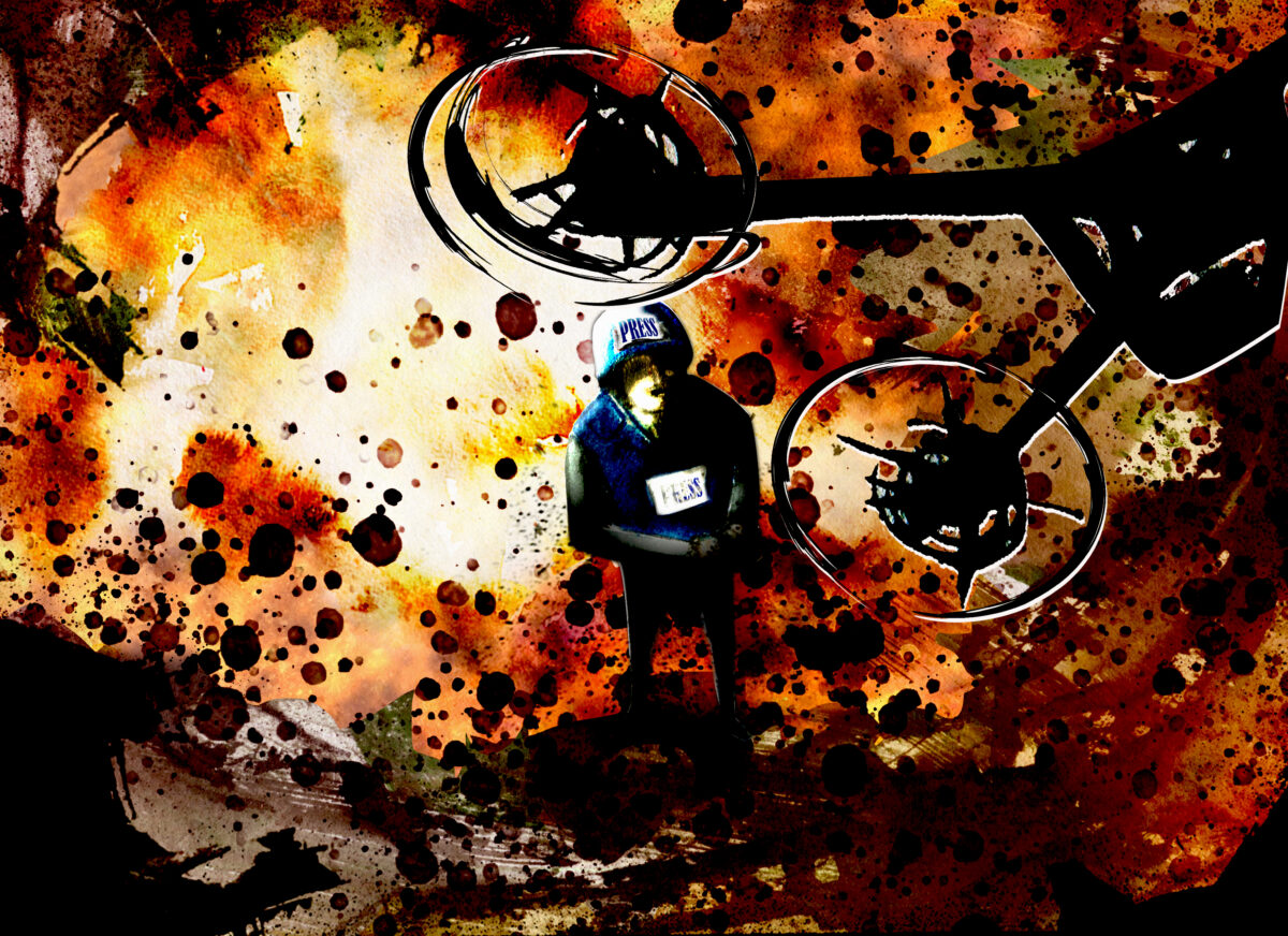
According to the Committee to Protect Journalists (CPJ), at least 165 Palestinian journalists have been killed since the Israel-Hamas war began in October 2023. In fact, according to CPJ, last year was the deadliest year for journalists worldwide since they began documenting deaths in 1992.
Gathering aerial footage of Gaza is a dangerous task, and Bellingcat along with our partners at Forbidden Stories, Le Monde, Die Zeit, Der Standard, Paper Trail Media, Arab Reporters for Investigative Journalism (ARIJ) and RFI identified several cases where drone journalists were killed or injured shortly after capturing aerial images.
The Gaza Project is a collaborative investigation coordinated by Forbidden Stories, involving more than 40 journalists representing 12 media outlets (Forbidden Stories, Paper Trail Media, RFI, Bellingcat, Die Zeit, Le Monde, France 24, ARIJ, The Seventh Eye/Shakuf +972 Magazine, ZDF and Der Standard) who continued the work of Gazan journalists and investigated about the threats and difficulties they are facing.
Illustration (c) Ann Kiernan.
Israel said early on in the war it could not guarantee safety of journalists in Gaza. Hamas has also been known to use drones to target Israel Defense Forces (IDF) positions and has used drone footage in propaganda videos. The investigative consortium contacted the IDF about the cases mentioned in this story, how they determined the drones posed a threat, the IDF rules of engagement with drones and how they define someone as a terrorist. The IDF did not answer specific questions about individual cases, nor did they provide further details about the two individuals in this piece, but they did tell us the IDF rejects outright the allegation of systemic attack on journalists.
“The IDF cannot address operational directives and regulations as they are classified. However, every operational action or strike is mandated by IDF directives, which instruct commanders to apply the basic rules of the law of armed conflict,” they said.
The full cost of the war still needs to be assessed through on the ground visits, when a permanent ceasefire is agreed, but in the meantime, satellite imagery combined with drone footage and other imagery captured by journalists in Gaza has been critical to lay bare the level of destruction.
For instance, a brief drone video lasting just over one minute and published in January this year by the AFP news agency after the first phase of the recent ceasefire was implemented, shows the rubble of scores of hollowed-out homes in Rafah. Some are completely levelled, others severely damaged.
The most recent interim damage assessment compiled by the World Bank, European Union and United Nations estimates almost 300,000 homes have been damaged or destroyed across Gaza and that 95% of hospitals are non-functional.
In order to continue the reporting on the extent of damage caused by the war in Gaza, Bellingcat and our partners are sharing satellite imagery and using a 3D model technique called photogrammetry to capture and show the areas the journalists had been filming or were unable to report on.
On February 15, 2024, about six months into the conflict, the United Nations shared a short video on social media showing dozens of hollowed out or partially collapsed buildings located in Gaza City’s Al-Shati Refugee Camp. The video starts with a birds-eye view filmed by a drone that shows entire blocks levelled in the compact neighbourhood.
Over the course of more than 12 months of conflict, Al-Shati Refugee Camp saw heavy destruction.
The neighbourhood and its surroundings were an early target for IDF ground operations inside Gaza, with the IDF announcing in mid-November 2023 that it had completely captured the area. The IDF said it was a main Hamas stronghold. One video geolocated by a Geoconfirmed volunteer shows the heavily damaged coastal side of the Al-Shati Refugee Camp a year later. The camp also abuts an archeological site to the north that was potentially damaged by the ground operation and airstrikes, as previously documented by Bellingcat and Forensic Architecture.
The images shared by UNRWA were filmed using a drone by Palestinian journalist Abdallah Al-Hajj. Nine days after they were posted online, he was back filming in the same area when he was seriously injured in an Israeli army strike, losing both his legs.
Speaking to our partners Forbidden Stories, Al-Hajj said he felt a journalistic responsibility to continue filming in Gaza during the war but took several precautions including only filming when clashes were over and when there was no immediate conflict in the vicinity. On the day he was injured, he said he’d only filmed with the drone for about five minutes and completed the filming when he was hit. He told our partners at Forbidden Stories he wasn’t wearing his press vest because he felt identifying himself as a journalist put him at greater risk.
The IDF previously told Le Monde that it had“eliminated by an IAF aircraft” a “terrorist cell using a drone, posing an imminent threat to forces in the Shati area.”Apparently the same strike was referenced in this reporting from February 25.
It’s not clear where the threatened forces referred to in the IDF statement were. It was reported that the IDF conducted a two-week-long raid in Al-Shati Refugee Camp in early February but it was apparently finished by February 15.
Based on SkySat imagery from Planet Labs, IDF vehicles were visible earlier in the month on February 8 about 2.5km from Al-Shati Refugee Camp near Gaza City’s Islamic University campus. The vehicles were gone a week later in February 14 imagery.
Photos and videos show that the IDF were present about 3.5km south of Al-Shati Refugee Camp along the Al-Rashid Road throughout the month of February, though it’s not clear if they were still present at the location when Al-Hajj was filming.
After the strike, SkySat imagery from Planet Labs shows that Al-Hajj’s home south of Gaza City in the Zeitoun neighbourhood was destroyed. It was standing in February 24 imagery but in February 28 imagery showed that it was gone.
We asked the IDF about Al-Hajj’s case including asking them to explain the immediate threat that was posed by the drone, why he was hit and what information they had about him but they did not respond to specific questions about this case.
Al-Hajj told our partners Forbidden Stories the accusation that he was part of a terrorist cell or affiliated with Hamas was a “false and unfounded charge.”
Additionally he said he was checked by IDF troops twice after the incident, in Al-Shifa Hospital where he was admitted and again when he left the Gaza Strip via a Netzarim checkpoint to travel to Qatar for medical treatment. “If I were Hamas, I would not have gone out of the Gaza Strip for treatment,” he said.
To continue documenting the changes in Al-Shati Refugee Camp brought about by the war, Bellingcat used drone images provided by Forbidden Stories to create a 3D model of the current state of the area through photogrammetry, a technique that reconstructs objects in 3D by analysing the parallax between multiple photos.
Photogrammetry is the science of extracting measurements from photographs. In this case, photogrammetry is employed to extract large scale, measured 3D models from a dataset of aerial photographs of Gaza captured by a drone.
Bellingcat processed the 3D models of Jabalia Refugee Camp and Al-Shati Refugee Camp using Agisoft Metashape, which requires a paid license. Alternative open-source programs for photogrammetry include Meshroom and COLMAP.
The 3D models were created from the drone photos in four steps, though different steps may be applicable to different scenarios. First, corresponding features are detected and matched between images. Then, using the corresponding features, camera positions are triangulated using the camera parameters (ie. focal length, pixel size, lens distortion) and repeatedly adjusted to increase the accuracy of the reconstructed camera positions through bundle block adjustment. Next, depth maps are created for each image using dense stereo matching, which compares images from similar viewpoints to find the small differences between them caused by parallax. These depth maps are used to create a 3D mesh that serves as an accurate recreation of Gaza. Finally, a texture is created by projecting the original drone photos onto the mesh in a way that seamlessly blends them, giving the final result of a photorealistic and dimensionally accurate 3D model.
Photogrammetry is used to create a photorealistic and dimensionally accurate 3D model. Credit: Agisoft Metashape. Annotated by Thomas Bordeaux.
Photogrammetry and the 3D models do have some shortcomings – in particular, areas not visible to the camera cannot be accurately reconstructed, such as the insides of heavily damaged buildings that are hidden by overhanging floor slabs. Further, the varying distance between the camera and the features it captures leads to variances in the level of detail in the model, as does the varying number of photographs of any given feature – for example the narrow alleys in Al-Shati Refugee Camp can only be seen from certain angles in the photogrammetry, meaning they aren’t as accurately depicted as more visible areas such as the courtyards of UNRWA schools in Jabalia Refugee Camp.
While satellite images can be difficult to interpret and are limited in resolution, the 3D models produced with photogrammetry allow viewers to place themselves in the environment. This approach provides an unparalleled look at the landscape of Gaza after nearly eighteen months of war, including buildings reduced to rubble, craters left behind by intense bombing, and thousands of tents sheltering displaced persons. A similar technique has been used in other open source investigations, notably in the recreation of the Mariupol Drama Theatre in Ukraine which was used as a civilian shelter until it was bombed by Russian forces in 2022, as well as numerous investigations by Forensic Architecture.
Within the models presented on this page, we have identified key sites including schools, homes and areas damaged by fighting.
About a month before Al-Hajj was injured in Al-Shati Refugee Camp, Mustapha Thuraya and his colleague Hamza Al-Dahdouh were killed in an IDF strike while they were driving in southern Gaza on their way back from reporting in Al-Nasr Village. Thuraya was a freelance video journalist who had filmed for Al Jazeera, AFP, Reuters, and Getty Images among others. He was killed on January 7, 2024 in Al-Nasr Village northeast of Rafah, shortly after filming with his drone.
According to reporting by the Washington Post, Thuraya and Al-Dahdouh arrived at the location about 10:30am, when an airstrike forced them to leave the area by car. They were following an ambulance when they were struck while on the road at approximately 11:10am.
Thuraya began actively covering the war not long after it started, sharing dozens of videos on his social media pages. In many of the videos, his drone controls are visible in his hands as he filmed himself in front of scenes of destruction. In some of the videos he can be seen wearing a press vest, though it is unclear if he was wearing it on the day he was hit.
The final thing Thuraya filmed with his drone was the site of an IDF airstrike in southern Gaza that took place the same day. The area he was filming is a rural part of southern Gaza that sits between Khan Yunis to the north and Rafah to the south. Overall, the area was relatively untouched by Israeli ground operations, though satellite imagery shows that the IDF cleared a small area of greenhouses within 1km of the airstrike location in late July and August 2024. Recent Planet Labs imagery from January 2025 shows that most of the larger area is still intact, including the majority of the greenhouses.
Before and after satellite imagery from Planet Labs shows the location where Mustafa Thuraya and his colleagues were filming shortly before they left in their vehicle and were killed while on the road south. The most recent imagery shows that some greenhouses have been destroyed but otherwise the area is largely unchanged. Credit: Planet Labs PBC.
The IDF initially claimed the January 7 strike on Thuraya and Al-Dahdouh’s car was in response to drone activity that posed a threat to IDF troops. They later released further reasoning for the strike, stating that Israel’s military intelligence department had confirmed that Dahdouh was a member of Palestinian Islamic Jihad and Thuraya was a member of Hamas, — something rejected by both Al Jazeera, which they were working for at the time — and the journalists’ families.
The Washington Post, quoting Thuraya’s friend and fellow journalist Shadi al-Tabatiby, said Thuraya had previously worked for around five years as a photographer for the Ministry of Religious Endowments, part of Gaza’s Hamas-led government. It’s not clear when his employment ended.
Our analysis found the closest potential IDF activity to where the strike on Thuraya’s vehicle took place — clearing activity that was visible near a cluster of buildings — was more than 5km away, something that’s visible in Planet SkySat imagery from the day of the strike. An analysis from The Washington Post came to a similar conclusion regarding the IDF presence near where Thuraya was filming, even though they analysed a smaller area, finding no evidence of IDF military activity or deployments within 2km of the site.
The Washington Post was also able to review the drone footage filmed by Thuraya and found that no IDF “soldiers, aircraft or other military equipment” was visible in the footage.
The IDF did not respond to the consortium’s specific questions about Thuraya and the circumstances surrounding his killing.
While the area in southern Gaza that Thuraya was filming before he was killed has remained mostly unchanged, Rafah — where he and Al-Dahdouh were returning to following the filming — has been decimated.
Drone imagery is still dangerous to capture in the south, even during the ceasefire. AFP published drone footage shortly after the first phase of the ceasefire was agreed, but it only covered a small area in Rafah. High resolution satellite imagery remains one of our best ways to observe the mass destruction in Rafah. Bellingcat covered this in August last year, but since then more buildings have been destroyed with entire neighborhoods that were previously standing demolished, particularly near the border areas.
Hundreds of buildings in both the central Rafah area near the large marketplace and the Al-Ganinam neighbourhood have been demolished. The few remaining buildings in the Tal as-Sultan neighbourhood we examined in the August investigation have also been razed to the ground.
Bellingcat is sharing the same satellite imagery analyzed in last year’s piece alongside more recent Planet imagery captured after the ceasefire on January 30 2025.
Credit: Planet Labs PBC.
Other Drone Journalists Slain and Photogrammetry of Jabalia
Prior to the ceasefire the Committee to Protect Journalists identified at least three otherdrone journalists who were killed in IDF strikes, but we have not been able to find further open source details on circumstances around their deaths.
One area that was difficult to film prior to the recent ceasefire because it was too dangerous was the Jabalia Refugee Camp and its surrounding area. This was one of the worst affected areas of Gaza, which Bellingcat documented earlier this year.
Bellingcat was able to create a photogrammetry model of one of the worst hit areas in Jabalia Refugee Camp using drone footage provided by Forbidden Stories which was captured during the recent ceasefire.
Ongoing Risks to Palestinian Journalists in Gaza
On Saturday, March 15, two IDF air strikes in the northern Gaza city of Beit Lahia killed at least seven people, including Mahmoud Samir Isleem Al-Basos also known as Mahmoud Al-Basos, a drone journalist who previously provided work to Reuters and the Turkish news agency Anadolu
Among the dead were aid workers and cameramen on a mission for the London-based Al-Khair Foundation who said they were filming preparations of a Ramadan iftar meal and documenting site preparation for the extension of the camp.
“We were deeply saddened to learn that journalist Mahmoud Al-Basos, whose work Reuters published in the past few weeks, was killed in Gaza by an Israeli strike while on a mission for the Al-Khair Foundation. Our thoughts are with his family at this difficult time,” a Reuters spokesperson told us.
Mahmoud Samir Isleem Al-Basos was previously hired by Forbidden Stories to film drone footage for this project during the recent ceasefire. This initiative aimed to continue the work of drone journalists who had been killed while documenting the war and help readers visualise the unprecedented scale of destruction through detailed 3D aerial maps.
The IDF stated the March 15 strikes targeted “terrorists,” including two operating a drone, and released a list of names and photos. The IDF statement contained misidentifications and names of individuals the media office in Gaza said had not been killed, causing confusion.
Mahmoud Samir Isleem Al-Basos was neither named nor pictured in the list published by the IDF. Instead, the IDF listed another individual, with a similar name, describing him as a “Hamas terrorist operating under journalistic cover,” and said there was a link between the drone used in Beit Lahia and Islamic Jihad.
However, the consortium’s investigations indicate the individual named by the IDF has no direct link to Mahmoud Samir Isleem Al-Basos, and was not killed in the strike.
Al-Khair Foundation said, meanwhile, they “utterly refute” any claims that their team were connected to militants. They say that the members were deliberately targeted while on a “purely humanitarian mission.”
We geolocated the two strikes in Beit Lahia, and according to our findings, the first was approximately 2km from the Israeli border and an IDF outpost situated nearby and the second approximately 3km away, raising questions about the threat described by the IDF.
Asked twice by the consortium to provide evidence to support the different accusations, the IDF refused, stating it “will not elaborate on the published statements”.
Reserve Lieutenant Colonel Maurice Hirsch, who served for 19 years in the Israeli army’s legal corps, told our partners at Paper Trail Media there is an inherent risk in flying a drone during a conflict in proximity to fighting forces.
He said if a soldier spotted a drone in a combat zone near fighting forces, “I certainly wouldn’t assume any wrongdoing if that drone and its operators were targeted (…) it wouldn’t be unreasonable to assume they were part of an enemy force.”
Our partners at Forbidden Stories also spoke to IDF reservist Michael Ofer-Ziv who served during the recent conflict, including for the first two months of the war in the Israeli military centre of Sde Teiman where he spent his time observing black-and-white footage filmed from Gaza. His role was to verify that the IDF wasn’t firing on its own soldiers. Ofer-Ziv completed his tour in December and has refused to return to service, signing a letter stating that he is no longer willing to participate in the war.
“At no point during this war did I receive an official document outlining the rules of engagement. And that’s a problem, because it leaves a lot of room for interpretation,” he said.
He didn’t know of the Gazan drone journalists we investigated but said there was an “understanding and a general vibe in the war room” that “if you see anyone piloting a drone, and that drone is not ours, you shoot the drone and the person who uses it, no questions asked.”
Asked about journalists using drones he told Forbidden Stories: “We never spoke of it.”
We contacted the IDF as part of the investigative consortium and asked whether they had a specific policy for dealing with drones in Gaza, and if so how they distinguished civilians from military targets. We asked about the individual cases listed above but were not provided any further details. The IDF has previously claimed that Thuraya was a member of Hamas, a claim which Al Jazeera and his family deny, and stated they hit a “terrorist cell” target in the IDF strike that injured Al-Hajj. Al-Hajj says this a “false and unfounded” charge.
The IDF did not answer specific questions about individual cases, nor did they provide further details or evidence about the incidents outlined above, but they told us the IDF rejects outright the allegation of systemic attack on journalists.
“The IDF cannot address operational directives and regulations as they are classified. However, every operational action or strike is mandated by IDF directives, which instruct commanders to apply the basic rules of the law of armed conflict (LOAC).”
They reiterated that the IDF is committed to principles of distinction, proportionality and precautions and that the IDF only strikes members of organised armed groups and individuals directly participating in hostilities. They told us some of the people listed by Forbidden Stories were members of Hamas’ military wing and were therefore lawful targets under international law, but they did not provide evidence to support this.
They also told us that “the IDF takes all feasible measures to mitigate harm to civilians, including journalists. Regarding objects, the IDF only strikes military objects. The IDF does not deliberately strike civilian objects, including those affiliated with media outlets or belonging to journalists, provided that they are not legitimate military targets.”
In their reply, they stated “the incidents have been referred to relevant mechanisms for further investigation.” But did not confirm whether the specific cases highlighted here are being investigated, and did not specify which incidents they were referring to. They also stated that exceptional incidents are subject to lessons-learned processes and are thoroughly examined and addressed accordingly by the appropriate enforcement mechanisms, and may lead the relevant cases to command, disciplinary, or criminal measures.
Press Freedom Experts
The Committee to Protect Journalists told us that drone use for journalism is still a relatively new trend.
“We encourage journalists generally to do their own risk assessments depending on their own situation on a case by case basis,” Doja Daoud, CPJ’s Levant Program Coordinator, told us.
She made clear that: “A journalist shouldn’t be killed and should be protected under international law.”
Daoud said CPJ had documented cases where drone journalists were killed. And in at least one case, a journalist had told them his drone had been disabled or controlled remotely.
“So there are other ways to deal with a drone, even in conflict areas or in a proximity of Israeli soldiers, without killing a journalist.”
As for IDF claims about journalists being combatants, Daoud said in many cases, including that of Mustapha Thuraya, CPJ is still yet to see any clear proof.
“Israel has repeatedly made similar unproven claims without producing any credible evidence. And to date CPJ has documented multiple cases with no evidence at all that any journalist was engaged in militant activity.”
“Attempts to smear, delegitimise, and criminalise journalists who are doing their job are outrageous and irresponsible as they put journalists at further risk. And targeting journalists with disinformation endangers them more.”
Irene Khan, the United Nations Special Rapporteur on Freedom of Expression and Opinion told us that with no western reporters allowed in, local Palestinian journalists, “are putting their lives on the line so that we may be better informed on what is happening and so that the atrocities being performed there can be exposed.”
Using drones to show what’s happening has only increased that risk, with Khan adding that since using commercial drones as a tool is still relatively new — for both journalists and combatants — and the rules are less clear.
“International humanitarian law does not say that you are not allowed to use drones, because it is a civilian object and there are many civilian objects that can be converted and used for military purposes. But it is not wrong as a civilian to use it.”
But, Khan says, the onus is on the combatants — the IDF and armed groups in Gaza — to ensure civilians are not being targeted if it’s difficult to distinguish the purpose of a drone. From a legal point of view, international humanitarian law heavily favours journalists.
“So the onus is actually on the combatants to make sure that if we cannot distinguish, then we need to do more to ascertain whether we might, by mistake, kill a civilian, we might kill a journalist.”
“And in all those areas, I think the standards that the IDF seem to be applying are lower than what I would call due diligence. I think there has been a tendency on the side of the IDF to assume that some of these journalists have links with Hamas and therefore are legitimate targets.”
With such a high journalist death toll throughout the war, Khan says there needs to be more done to protect journalists in the future — including carrying out independent investigations.
“I come back to the issue of impunity. It has to be addressed. So every time a journalist is killed, there should be a full investigation as to what happened and to make sure that if there was a mistake made, what are they doing correcting those mistakes? … And I don’t understand if the IDF is so sure that they didn’t make a mistake, why are they not allowing others to come in and investigate it?”
Some Palestinian journalists are continuing to film with mobile phones, cameras and drones, despite the risks.
With the recent ceasefire collapse, the risk to journalists operating on the ground is likely to increase again, heavily restricting our view of the impact of the conflict on Palestinian communities in the Gaza strip.
Youssr Youssef, Magdalena Hervada, Charlotte Maher and Logan Williams contributed to this report.
Photogrammetry models in this piece were created using Agisoft Metashape and Cesium. Source Credit: Forbidden Stories/Stringer. Photogrammetry model: Bellingcat/ Thomas Bordeaux.
Bellingcat would like to thank our partners at Forbidden Stories, Die Zeit, Der Standard, Le Monde, RFI, ARIJ and Paper Trail Media for collaborating on this project.